- Home
- Techniques
- Seismic Tomography
Seismic Tomography
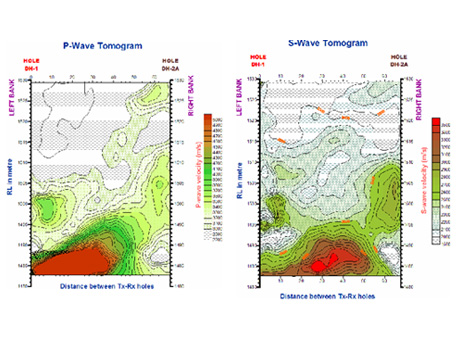
Seismic tomography is one of the latest high resolution geophysical cross-hole techniques for locating vertical subsurface anomalies between two or more drill holes using a pictorial display. Seismic tomography, as with medical tomography, allows us to image the interior of a given structure. Basic principle is similar to seismic refraction- Travel times of the seismic waves traveling through the medium are measured and seismic velocities are determined at different points along the depth of the borehole. Using these seismic velocities a two dimensional image or section through a three dimensional body showing variation in seismic velocities called Tomograms are generated. Seismic velocity of subsurface layers thus determined is subsequently interpreted for assessing the geotechnical properties and homogeneity of subsurface material.
Methodology:
- A downhole seismic source and downhole receivers are lowered in boreholes on either side of the region to be imaged.
- Seismic travel times are measured between source and receiver locations(the number of locations depends upon the requirement and the number of channels used with the Seismograph (12 / 24 / 48 Channel Seismograph).
- These travel times are then inverted into a 2-D seismic velocity section known as Tomogram.
How Tomograms are generated:
- Region between the boreholes is divided into a grid of cells or node and each is assigned with seismic velocity.
- Travel times are calculated using velocities assigned to each cell & the calculated travel times are compared with the observed travel times. Iteration process is repeated by assigning different seismic velocities to each cell until best fit is obtained.
- After the data processing, finally, the seismic section called Tomogram is obtained, with seismic velocities in each cell.
- Zones of lower seismic wave velocity can be detected & subsequently interpreted as weak/ fracture zones, cracks, fractures, voids etc.
Advantages:
- Only technique permitting mapping of vertical subsurface anomalies with high resolution.
- Maps contrast in elastic properties of soil using seismic velocities, which can be correlated with crack, fracture, voids, cavities etc.
- Gives reliable results due to large ray path coverage.
- Valuable sample data available for geotechnical investigations & correlation.
- Can be conducted even in undulating & rough terrains.
Disadvantages:
- Technique can not be used for long distance boreholes.
- Needs cased drill holes which makes these tests expensive.
Seismic tomography can be employed in situations where problems are suspected, or sections suspected of containing concealed problems. In addition, the method can be used to verify the integrity and quality of the materials used during construction.
Applications:
- Quantitative evaluation of any material by seismic velocity analysis;
- Diagnosis of problem areas in 2-D or 3-D;
- Quality control tool for structural repairs.
- Valuable sample data available for geotechnical investigations & correlation.
- Can be conducted even in undulating & rough terrains.